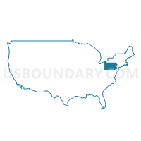
Allegheny County (North)--Franklin Park Borough & Allison Park PUMA, Pennsylvania
About
Outline
--Franklin+Park+Borough+%26+Allison+Park+PUMA%2c+Pennsylvania_A280.png)
Summary
| Unique Area Identifier | 193924 |
| Name | Allegheny County (North)--Franklin Park Borough & Allison Park PUMA |
| State | Pennsylvania |
| Area (square miles) | 206.40 |
| Land Area (square miles) | 203.94 |
| Water Area (square miles) | 2.46 |
| % of Land Area | 98.81 |
| % of Water Area | 1.19 |
| Latitude of the Internal Point | 40.60644690 |
| Longtitude of the Internal Point | -79.95892940 |
Maps
Graphs
Select a template below for downloading or customizing gragh for Allegheny County (North)--Franklin Park Borough & Allison Park PUMA, Pennsylvania
--Franklin+Park+Borough+%26+Allison+Park+PUMA%2c+Pennsylvania_T0.png)
--Franklin+Park+Borough+%26+Allison+Park+PUMA%2c+Pennsylvania_T1.png)
--Franklin+Park+Borough+%26+Allison+Park+PUMA%2c+Pennsylvania_T2.png)
--Franklin+Park+Borough+%26+Allison+Park+PUMA%2c+Pennsylvania_T3.png)
--Franklin+Park+Borough+%26+Allison+Park+PUMA%2c+Pennsylvania_T4.png)
--Franklin+Park+Borough+%26+Allison+Park+PUMA%2c+Pennsylvania_T5.png)
--Franklin+Park+Borough+%26+Allison+Park+PUMA%2c+Pennsylvania_T6.png)
--Franklin+Park+Borough+%26+Allison+Park+PUMA%2c+Pennsylvania_T7.png)
Neighbors
Neighoring Public Use Microdata Area (by Name) Neighboring Public Use Microdata Area on the Map
- Allegheny County (East)--Monroeville Municipality, Plum & Wilkinsburg Boroughs PUMA, PA
- Allegheny County (North Central) PUMA, PA
- Allegheny County (West) PUMA, PA
- Beaver County (South) PUMA, PA
- Butler County PUMA, PA
- Indiana & Armstrong Counties PUMA, PA
- Westmoreland County (Northwest)--Murrysville Municipality & New Kensington City PUMA, PA
Top 10 Neighboring County (by Population) Neighboring County on the Map
- Allegheny County, PA (1,223,348)
- Westmoreland County, PA (365,169)
- Butler County, PA (183,862)
- Beaver County, PA (170,539)
- Armstrong County, PA (68,941)
Top 10 Neighboring County Subdivision (by Population) Neighboring County Subdivision on the Map
- Ross township, Allegheny County, PA (31,105)
- Shaler township, Allegheny County, PA (28,757)
- McCandless township, Allegheny County, PA (28,457)
- Cranberry township, Butler County, PA (28,098)
- Plum borough, Allegheny County, PA (27,126)
- Moon township, Allegheny County, PA (24,185)
- Hampton township, Allegheny County, PA (18,363)
- Franklin Park borough, Allegheny County, PA (13,470)
- New Kensington city, Westmoreland County, PA (13,116)
- West Deer township, Allegheny County, PA (11,771)
Top 10 Neighboring Place (by Population) Neighboring Place on the Map
- Plum borough, PA (27,126)
- Allison Park CDP, PA (21,552)
- Franklin Park borough, PA (13,470)
- New Kensington city, PA (13,116)
- Fernway CDP, PA (12,414)
- Lower Burrell city, PA (11,761)
- Glenshaw CDP, PA (8,981)
- Economy borough, PA (8,970)
- Ambridge borough, PA (7,050)
- Oakmont borough, PA (6,303)
Top 10 Neighboring Unified School District (by Population) Neighboring Unified School District on the Map
- North Allegheny School District, PA (50,013)
- Seneca Valley School District, PA (46,966)
- Shaler Area School District, PA (39,285)
- North Hills School District, PA (37,876)
- Kiski Area School District, PA (28,857)
- Fox Chapel Area School District, PA (28,727)
- Plum Borough School District, PA (27,126)
- Moon Area School District, PA (26,825)
- Ambridge Area School District, PA (23,827)
- Pine-Richland School District, PA (22,597)
Top 10 Neighboring State Legislative District Lower Chamber (by Population) Neighboring State Legislative District Lower Chamber on the Map
- State House District 12, PA (70,527)
- State House District 44, PA (70,046)
- State House District 28, PA (67,105)
- State House District 30, PA (61,376)
- State House District 54, PA (60,370)
- State House District 11, PA (60,130)
- State House District 33, PA (59,492)
- State House District 16, PA (58,551)
- State House District 10, PA (58,463)
- State House District 60, PA (58,162)
Top 10 Neighboring State Legislative District Upper Chamber (by Population) Neighboring State Legislative District Upper Chamber on the Map
- State Senate District 40, PA (256,162)
- State Senate District 37, PA (252,115)
- State Senate District 47, PA (225,797)
- State Senate District 45, PA (220,981)
- State Senate District 38, PA (213,989)
Top 10 Neighboring 111th Congressional District (by Population) Neighboring 111th Congressional District on the Map
- Congressional District 18, PA (653,385)
- Congressional District 4, PA (647,418)
- Congressional District 12, PA (612,384)
Top 10 Neighboring Census Tract (by Population) Neighboring Census Tract on the Map
- Census Tract 4090, Allegheny County, PA (11,497)
- Census Tract 4120.01, Allegheny County, PA (8,605)
- Census Tract 9124.01, Butler County, PA (7,813)
- Census Tract 6018, Beaver County, PA (7,360)
- Census Tract 9127, Butler County, PA (7,307)
- Census Tract 4141.02, Allegheny County, PA (7,040)
- Census Tract 4110, Allegheny County, PA (6,915)
- Census Tract 5261.01, Allegheny County, PA (6,902)
- Census Tract 4131, Allegheny County, PA (6,609)
- Census Tract 4070.02, Allegheny County, PA (6,597)
Top 10 Neighboring 5-Digit ZIP Code Tabulation Area (by Population) Neighboring 5-Digit ZIP Code Tabulation Area on the Map
- 15237, PA (41,895)
- 15108, PA (40,153)
- 15068, PA (38,785)
- 16066, PA (28,060)
- 15044, PA (27,049)
- 15101, PA (24,292)
- 15090, PA (21,202)
- 15143, PA (19,660)
- 15116, PA (14,427)
- 16046, PA (14,396)


--Franklin+Park+Borough+%26+Allison+Park+PUMA in Pennsylvania.png)

--Franklin+Park+Borough+%26+Allison+Park+PUMA%2c+Pennsylvania.png)